Florida Panhandle
The Florida Panhandle stretches across the northwestern corner of the state, forming a long corridor between Alabama, Georgia and the Gulf of Mexico. Known for white-sand beaches, emerald-colored Gulf waters, historic cities, pine forests, rivers, springs and small coastal communities, the Panhandle offers a noticeably different Florida experience from the tropical landscapes and heavily developed metropolitan areas farther south.
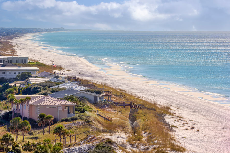
The region includes some of Florida’s best-known Gulf destinations, including Pensacola, Destin, Panama City Beach and Panama City, along with historic coastal communities, inland towns and the state capital of Tallahassee. Within the Panhandle are several smaller areas with identities of their own, including the Emerald Coast and Forgotten Coast.
Where Is the Florida Panhandle?
The Florida Panhandle occupies the northwestern portion of the state and extends west from the Big Bend area toward the Alabama state line. Its distinctive shape creates the narrow western extension visible on maps of Florida and places much of the region closer geographically to Alabama and Georgia than to Central or South Florida.
Interstate 10 crosses the Panhandle from east to west and serves as its principal inland highway, connecting communities including Pensacola, Crestview, DeFuniak Springs, Bonifay and the Tallahassee area. Along the Gulf, U.S. Highway 98 provides access to many of the region’s coastal communities and beaches.
Cities and Communities of the Florida Panhandle
Pensacola anchors the western end of the Panhandle and combines centuries of history with a strong military and aviation presence. Nearby Pensacola Beach and Perdido Key provide access to barrier-island beaches, while Gulf Breeze occupies the peninsula between Pensacola Bay and Santa Rosa Sound.
Farther east, Navarre, Fort Walton Beach, Destin, Miramar Beach and the communities of South Walton form one of the Panhandle’s most heavily visited coastal corridors. Panama City Beach and Panama City provide another major concentration of beaches, attractions, boating and waterfront recreation along the Gulf and St. Andrews Bay.
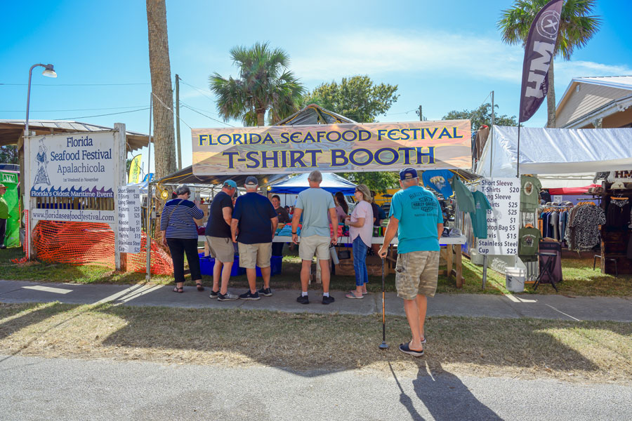
Continuing east, Port St. Joe, Apalachicola, St. George Island and Carrabelle introduce visitors to a quieter coastline shaped by fishing, maritime history, protected lands and relatively undeveloped beaches. Inland communities such as Crestview, DeFuniak Springs and Bonifay provide another side of Northwest Florida away from the Gulf.
Beaches of the Florida Panhandle
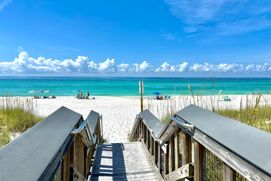
The Panhandle contains some of Florida’s most recognizable beaches. Much of the coastline is characterized by exceptionally light sand and Gulf water that can appear turquoise, emerald green or deep blue depending on weather, depth and light conditions. Barrier islands, bays, sounds and coastal dune systems create a varied shoreline extending across Northwest Florida.
Pensacola Beach, Navarre Beach, Okaloosa Island, Destin, Miramar Beach, South Walton and Panama City Beach are among the region’s major beach destinations. Farther east, Mexico Beach, Cape San Blas and St. George Island provide a different experience, with smaller communities and extensive areas of natural shoreline.
The Emerald Coast
The Emerald Coast is one of the best-known subregions of the Florida Panhandle. Centered around Destin, Fort Walton Beach, Okaloosa Island and South Walton, the area takes its name from the distinctive green and turquoise appearance of its Gulf waters.
Destin is particularly associated with recreational fishing and boating, while the communities along Scenic Highway 30A offer a collection of smaller beach towns, state parks and rare coastal dune lakes. Miramar Beach, Santa Rosa Beach, Grayton Beach, Seaside, Seagrove Beach, Alys Beach and Rosemary Beach are among the communities found along this portion of the Panhandle.
Pensacola and the Western Panhandle
Pensacola is one of Florida’s most historically significant cities and serves as a cultural and economic center of the western Panhandle. Its location on Pensacola Bay has influenced the city for centuries, while nearby Naval Air Station Pensacola has made military aviation an important part of the area’s modern identity.
Across the bay, Pensacola Beach occupies part of Santa Rosa Island and provides access to miles of Gulf shoreline. Portions of Gulf Islands National Seashore protect beaches, dunes, maritime forests and historic sites around the Pensacola area. Visitors can also explore the Pensacola Lighthouse and other sites associated with the area’s long maritime and military history.
Nearby Gulf Breeze provides convenient access to both Pensacola and the barrier islands. Families exploring the western Panhandle can also visit the Gulf Breeze Zoo, while the protected coastal landscapes west and east of Pensacola provide opportunities for swimming, hiking, paddling, fishing and wildlife viewing.
Destin, Fort Walton Beach and South Walton
The central portion of the Panhandle includes some of Northwest Florida’s most heavily visited beach destinations. Destin grew around fishing and remains closely associated with charter boats, marinas and recreational boating. Nearby Fort Walton Beach and Okaloosa Island provide additional beaches, accommodations and access to Santa Rosa Sound and the Gulf.
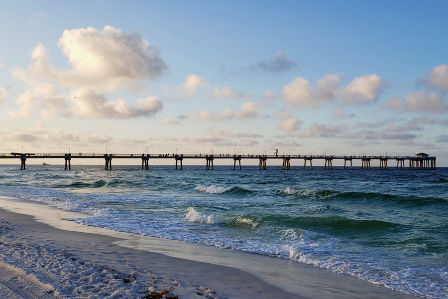
Natural areas remain an important part of this developed coastal corridor. Henderson Beach State Park protects a stretch of natural Gulf shoreline in Destin, while parks and conservation areas farther east preserve dunes, forests and coastal dune lakes throughout South Walton.
Panama City and Panama City Beach
Panama City and Panama City Beach form another major destination area in the central Panhandle. Although their names are similar, they are separate communities. Panama City sits primarily along St. Andrews Bay, while Panama City Beach extends along the Gulf shoreline to the west.
Panama City Beach is known for miles of white-sand beaches, fishing, diving, watersports and family attractions. Nearby St. Andrews State Park protects beaches and coastal habitat at the entrance to St. Andrews Bay, while undeveloped Shell Island is accessible by boat.
The Forgotten Coast
East of the Panhandle’s larger resort destinations, the coastline becomes quieter around Port St. Joe, Cape San Blas, Apalachicola, St. George Island and Carrabelle. Much of this area is commonly known as Florida’s Forgotten Coast, a regional identity associated with historic fishing communities, natural beaches, seafood, forests, bays and wildlife habitat.
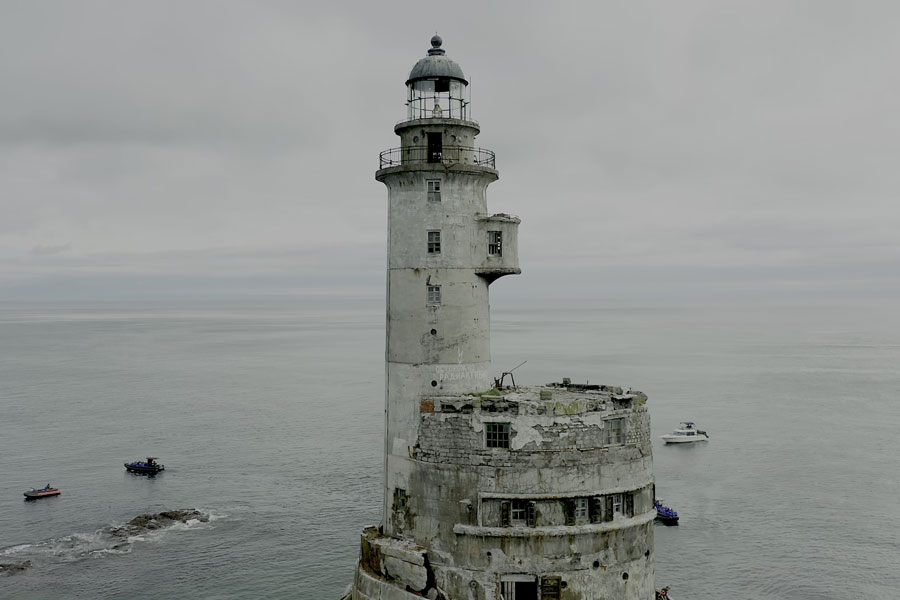
Apalachicola retains a strong connection to the Apalachicola River and Bay, while nearby St. George Island provides miles of Gulf beaches. State parks, wildlife refuges and conservation lands protect substantial portions of the surrounding coastline, giving this part of the Panhandle a considerably less developed character than many of Florida’s larger beach destinations.
Tallahassee and the Inland Panhandle
The Florida Panhandle extends well beyond its beaches. Tallahassee, Florida’s capital, lies inland near the Georgia border and presents a landscape of rolling hills, mature trees and forests that contrasts sharply with the flat coastal communities found farther west and south.
Government and higher education play major roles in Tallahassee, which is home to the Florida State Capitol, Florida State University and Florida A&M University. Museums, historic sites, parks, trails and nearby natural areas make the capital an important destination in its own right rather than simply a stopping point on the way to the coast.
Smaller inland communities reveal another side of Northwest Florida. Crestview, DeFuniak Springs and Bonifay sit away from the Gulf’s major resort corridor, surrounded by forests, rivers, farmland and smaller communities.
State Parks and Natural Areas
Protected lands are found throughout the Florida Panhandle and preserve environments ranging from Gulf beaches and coastal dunes to pine forests, rivers, wetlands and underground caverns. These natural areas provide an important counterpoint to the region’s developed beach communities.
Notable coastal destinations include Gulf Islands National Seashore, Henderson Beach State Park in Destin and St. Andrews State Park near Panama City Beach. Other parks and conservation areas protect dunes, coastal forests, barrier islands, bays and wildlife habitat farther east along the Panhandle.
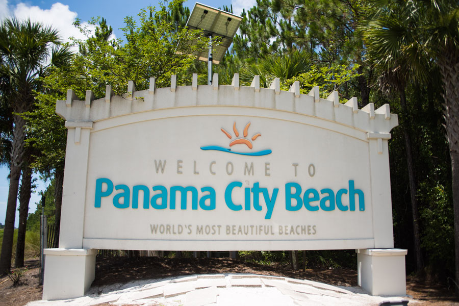
Large forests and wildlife management areas also preserve extensive portions of inland Northwest Florida. Together with the region’s rivers and springs, these protected lands allow visitors to experience a side of Florida that looks very different from the beachfront resort communities only a short drive away.
Rivers, Springs and Inland Recreation
Visitors who travel inland from the beaches encounter rivers, creeks and freshwater springs that support paddling, fishing, swimming and wildlife viewing. The Blackwater, Choctawhatchee, Chipola and Apalachicola river systems are among the waterways that shape the Panhandle landscape.
Forested recreation areas provide opportunities for hiking, camping, bicycling and horseback riding. The interior Panhandle can feel far removed from Florida’s beach-resort image, with long stretches of pine forest, farmland, rivers and small towns creating a distinctly rural landscape.
Fishing and Boating
Fishing and boating are closely tied to life throughout the Florida Panhandle. Destin maintains a prominent charter-fishing industry, while Pensacola, Panama City and numerous smaller coastal communities provide access to bays, sounds, rivers and offshore Gulf waters.
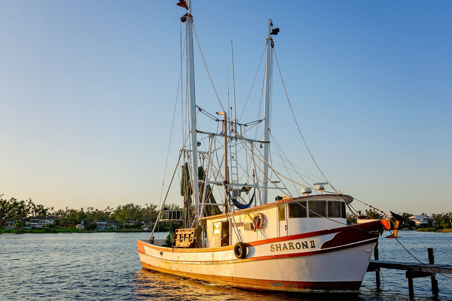
Visitors can fish from beaches and piers, join charter trips, explore protected bays by boat or paddle quieter waterways by kayak and canoe. The region’s extensive system of bays, sounds and barrier islands also creates many opportunities for recreational boating away from open Gulf waters.
History and Culture
The Panhandle contains some of Florida’s deepest layers of Indigenous, European, military and maritime history. Pensacola‘s strategic location on the Gulf made it an important settlement and military center, while Tallahassee developed as the territorial and later state capital.
Historic forts, downtown districts, museums, lighthouses and archaeological sites are found across the region. The Pensacola Lighthouse reflects the importance of navigation and maritime activity along the western Panhandle, while generations of fishing, shipping and seafood production helped shape coastal communities from Destin to Apalachicola.
Wildlife of the Florida Panhandle
The Panhandle’s beaches, barrier islands, bays, rivers, wetlands and forests support a wide range of wildlife. Dolphins are frequently seen in coastal waters, while sea turtles nest on Gulf beaches and numerous resident and migratory birds use the shoreline and inland habitats.
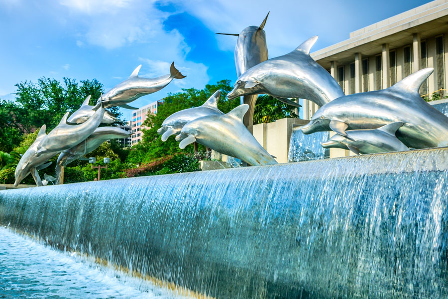
Natural areas farther inland support deer, alligators and many other native species. Visitors should observe wildlife from a safe distance, avoid disturbing nesting areas and follow regulations within parks, national seashores, refuges and other protected lands.
Food and Seafood
Seafood is an important part of Panhandle dining, particularly in communities with longstanding connections to commercial and recreational fishing. Gulf fish, shrimp, crab and oysters appear on menus from casual waterfront restaurants to more contemporary dining establishments.
The region also reflects culinary influences from the Deep South, particularly as visitors travel inland. Barbecue, Southern comfort food and traditional local restaurants become more prominent away from the resort areas, while larger destinations such as Pensacola, Destin, Panama City and Tallahassee offer increasingly diverse dining scenes.
Florida Panhandle for Families
Families can build a Panhandle trip around considerably more than the beach. Dolphin cruises, fishing trips, paddling, state parks, museums, historic sites, nature trails and wildlife viewing are available throughout the region. Attractions such as the Gulf Breeze Zoo provide additional options away from the shoreline.
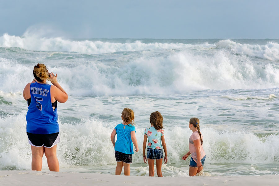
The variety also makes it possible to combine several different types of destinations in one trip. A visit might include a few days on the beach, an afternoon exploring historic Pensacola, a state park excursion and an inland stop before continuing across Northwest Florida.
When to Visit the Florida Panhandle
The Florida Panhandle has greater seasonal variation than much of Central and South Florida. Summers are hot and humid, with warm Gulf waters and frequent thunderstorms, while winters can bring genuinely cool weather and occasional freezing temperatures to inland areas.
Spring and fall are particularly comfortable for outdoor recreation, although Gulf water temperatures vary through the year. Summer remains a major beach season, while the quieter winter months can be well suited to sightseeing, hiking, fishing and exploring historic communities. Visitors traveling during hurricane season should monitor current weather conditions and forecasts.
Airports and Transportation
Several commercial airports provide access to different portions of the Florida Panhandle. Pensacola International Airport serves the western end of the region, Destin-Fort Walton Beach Airport provides convenient access to the Emerald Coast, Northwest Florida Beaches International Airport serves the Panama City Beach and Panama City area, and Tallahassee International Airport serves the eastern and inland Panhandle.
Because the Panhandle extends a considerable distance from east to west, driving times can be longer than visitors initially expect. Interstate 10 is the primary route for traveling across the interior, while U.S. Highway 98 follows much of the coastal region and connects numerous Gulf communities.
Vicinity of the Florida Panhandle
Additional Details
| Region | Northwest Florida / Florida Panhandle |
| Coast | Gulf Coast |
| Major Cities | Pensacola, Fort Walton Beach, Destin, Panama City Beach, Panama City and Tallahassee |
| Major Subregions | Emerald Coast and Forgotten Coast |
| Inland Communities | Crestview, DeFuniak Springs and Bonifay |
| Major Coastal Areas | Pensacola Beach, Okaloosa Island, South Walton, Scenic Highway 30A and St. George Island |
| Notable Parks and Protected Areas | Gulf Islands National Seashore, Henderson Beach State Park and St. Andrews State Park |
| Known For | White-sand beaches, emerald Gulf water, fishing, boating, military history, historic communities, pine forests, rivers, springs and state parks |
| Major Highways | Interstate 10 and U.S. Highway 98 |
| Major Airports | Pensacola International Airport, Destin-Fort Walton Beach Airport, Northwest Florida Beaches International Airport and Tallahassee International Airport |
Exploring the Florida Panhandle
The Florida Panhandle brings together several distinctly different versions of Northwest Florida within one region. Visitors can experience the historic streets and military heritage of Pensacola, the white beaches and emerald waters around Destin and Okaloosa Island, the active coastal atmosphere of Panama City Beach, and the quieter communities around Port St. Joe and St. George Island.
The region also extends well beyond its beaches. Tallahassee introduces visitors to Florida’s capital and the rolling, wooded landscape of the eastern Panhandle, while Crestview, DeFuniak Springs and Bonifay provide access to inland Northwest Florida. Along the Gulf, protected destinations including Gulf Islands National Seashore, Henderson Beach State Park and St. Andrews State Park preserve beaches, dunes and coastal habitat alongside the region’s developed communities.
Whether a trip focuses on the Emerald Coast, Scenic Highway 30A, historic Pensacola, the beaches around Destin and Panama City Beach, or the smaller coastal and inland communities farther east, the Florida Panhandle offers considerably more variety than a single beach corridor. Use the city, beach, park, attraction and transportation links throughout this guide to explore individual destinations and plan the parts of Northwest Florida that best fit your trip.