Florida’s Forgotten Coast
Florida’s Forgotten Coast is a stretch of the eastern Panhandle where historic fishing towns, barrier islands, working waterfronts and protected natural areas still shape the character of the Gulf Coast. Centered around Apalachicola Bay and extending through communities such as Port St. Joe, Apalachicola, Eastpoint and Carrabelle, the region offers a quieter alternative to the larger beach destinations of Northwest Florida.
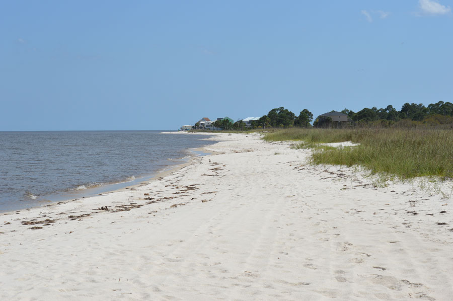
There are beautiful beaches here, but they are only part of the story. The Forgotten Coast is equally defined by oyster boats and fishing docks, historic buildings, coastal forests, estuaries, lighthouses and the enormous Apalachicola River system. St. George Island and Cape San Blas provide miles of Gulf shoreline, while Apalachicola preserves the atmosphere of an old Florida port town whose history remains closely connected to the water.
Why Is It Called the Forgotten Coast?
The name “Forgotten Coast” reflects the region’s relatively low level of development compared with many of Florida’s better-known coastal destinations. Small communities, forests, wetlands and protected shoreline occupy much of the landscape, and high-rise resorts are noticeably absent from large portions of the coast.
The term generally refers to the Gulf coastline around Gulf and Franklin counties, although there is no official boundary. Port St. Joe, Cape San Blas, Apalachicola, Eastpoint, St. George Island and Carrabelle form the heart of the region, with Mexico Beach sometimes included at its western edge.
U.S. Highway 98 connects much of the Forgotten Coast. Rather than functioning simply as a route between destinations, the highway passes directly through the landscape that defines the region, including small waterfront communities, forests, marshes and long views across bays and coastal waters.
Apalachicola and Its Working Waterfront
Apalachicola is the historic and cultural center of the Forgotten Coast. Located near the mouth of the Apalachicola River, the city developed as a Gulf port and later became closely associated with fishing, oysters and the seafood harvested from Apalachicola Bay.
The historic downtown remains compact and walkable, with preserved commercial buildings, locally owned shops, restaurants and galleries only a short distance from the waterfront. Docks, boats and seafood businesses provide a visible connection to the industries that helped build the community.
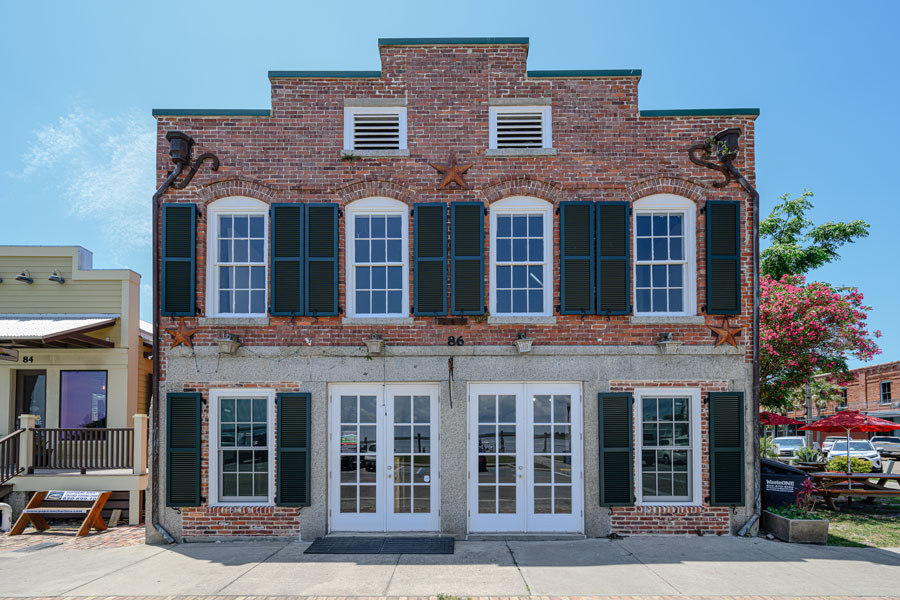
That combination of historic architecture and an authentic working waterfront is central to the Forgotten Coast experience. Apalachicola is not simply a beach town. Its relationship with the river, bay and Gulf has influenced its economy, food, culture and appearance for generations.
Apalachicola Bay and the Oyster Heritage
Apalachicola Bay is one of the defining natural features of the Forgotten Coast. Freshwater flowing from the Apalachicola River meets saltwater from the Gulf, creating an estuarine environment that supports fish, shellfish, birds and other wildlife.
For generations, Apalachicola became particularly famous for its oysters. Harvesting, processing and selling oysters supported families and businesses throughout the area and became inseparable from the identity of the bay. The historic oyster fishery later experienced a severe decline, dramatically affecting both the ecosystem and the people whose livelihoods depended upon it.
That history remains visible in the region’s seafood culture, working docks, festivals and restaurants. Shrimp, Gulf fish, crab and other seafood are also important to local dining and commercial fishing, making the waterfront an essential part of understanding the Forgotten Coast rather than simply another attraction.
The Apalachicola River
The Forgotten Coast begins far beyond the shoreline. The Apalachicola River carries freshwater south through one of Florida’s most extensive river and floodplain systems before reaching Apalachicola Bay. Its flow influences the salinity, nutrients and ecological conditions of the estuary.
Forested wetlands, sloughs and backwaters surrounding the river support an extraordinary variety of plant and animal life. The landscape can be explored by boat or paddlecraft, revealing a wild interior that contrasts sharply with the open beaches only a short distance away.

This connection between river, estuary and Gulf is one of the characteristics that distinguishes the Forgotten Coast from a conventional Florida beach destination. The communities along the coast are part of a much larger natural system extending deep into the interior of Northwest Florida.
St. George Island
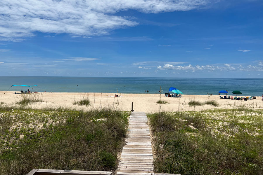
St. George Island forms a long barrier between Apalachicola Bay and the Gulf of Mexico. Reached by bridge from Eastpoint, the island combines vacation homes and small businesses with extensive stretches of beach and protected natural shoreline.
The eastern end of the island is preserved within Dr. Julian G. Bruce St. George Island State Park, where dunes, coastal vegetation and Gulf beaches extend away from the island’s developed areas. Swimming, fishing, kayaking, hiking, birding and beachcombing are among the ways visitors experience the park.
St. George Island also reflects the region’s maritime history. The Cape St. George Lighthouse stands near the center of the island as a reconstruction of the historic lighthouse that collapsed into the Gulf in 2005, incorporating salvaged material recovered from the original structure.
Port St. Joe and St. Joseph Bay
West of Apalachicola, Port St. Joe overlooks the protected waters of St. Joseph Bay. The community serves as a gateway to Cape San Blas and the St. Joseph Peninsula while providing marinas, restaurants and access to fishing, boating and paddling.
St. Joseph Bay adds another type of coastal environment to the Forgotten Coast. Its relatively shallow waters and extensive seagrass beds provide habitat for marine life and support recreational activities including kayaking, fishing and seasonal scalloping under applicable state regulations.

The Port St. Joe area also occupies an important place in Florida history. Delegates met at the former community of St. Joseph in 1838 to draft Florida’s first state constitution, years before Florida achieved statehood.
Cape San Blas and St. Joseph Peninsula
Cape San Blas curves into the Gulf west of Port St. Joe, forming part of the narrow St. Joseph Peninsula. Gulf beaches lie on one side while the protected waters of St. Joseph Bay extend along the other, allowing visitors to experience two very different coastal environments within a short distance.
The peninsula is known for white-sand beaches, dunes, fishing, paddling and broad Gulf sunsets. Development remains relatively low in scale, and natural shoreline continues to be one of the area’s principal attractions.
T.H. Stone Memorial St. Joseph Peninsula State Park protects coastal habitat toward the northern end of the peninsula. Hurricanes have repeatedly reshaped this exposed landscape, providing a reminder that the barrier islands and peninsulas of the Forgotten Coast are constantly changing natural features.
Eastpoint and the Fishing Community
Eastpoint sits directly across Apalachicola Bay from Apalachicola and serves as the mainland gateway to St. George Island. The community has longstanding connections to commercial fishing, oysters and seafood processing, making it another important part of the bay’s working-waterfront heritage.
Travelers crossing through Eastpoint encounter a different setting from the historic streets of Apalachicola or the vacation homes of St. George Island. Boats, docks, seafood businesses and views across the bay emphasize the practical relationship local communities have maintained with the surrounding waters.
Carrabelle and the Eastern Coast
Carrabelle lies east of the Apalachicola Bay communities where the Carrabelle River approaches St. George Sound. Fishing, boating and maritime activity remain prominent, while surrounding forests and conservation lands create a sparsely developed backdrop to the small waterfront community.
Nearby Crooked River Lighthouse was built to help guide vessels navigating the waters around Dog Island and the approaches to Carrabelle. Together with the Cape St. George Lighthouse, it helps tell the story of a coastline where islands, shoals, storms and shifting channels made dependable navigation essential.
The Carrabelle area also played a role during World War II, when nearby beaches and coastal areas were used for amphibious military training. Today, the eastern Forgotten Coast is considerably quieter, attracting visitors interested in fishing, boating, nature and uncrowded coastal surroundings.
Lighthouses of the Forgotten Coast
Lighthouses are particularly closely associated with the Forgotten Coast because of the complicated maritime geography surrounding its bays and barrier islands. Historic lights helped ships navigate Gulf waters and locate safe approaches to ports and river entrances.
The Cape St. George Lighthouse and Crooked River Lighthouse are reminders of that history, while other lighthouse sites and offshore structures illustrate the effects of storms and erosion along this constantly changing shoreline.

The region’s maritime story extends beyond its lighthouses. Shrimp boats, fishing vessels, oyster boats, docks and marinas continue a relationship with the Gulf that predates modern tourism and remains visible throughout the Forgotten Coast.
A Coast Shaped by Nature
One of the most noticeable differences between the Forgotten Coast and many other Florida coastal regions is the amount of undeveloped land surrounding its communities. State parks, forests, wildlife refuges, estuaries and conservation areas occupy large portions of Gulf and Franklin counties.
Tate’s Hell State Forest covers a vast area inland from the coast, while protected lands around the Apalachicola River and Bay preserve wetlands, forests and estuarine habitat. St. George Island State Park and St. Joseph Peninsula State Park protect significant stretches of barrier-island and peninsula shoreline.
The result is a landscape in which visitors frequently travel through miles of forest, marsh or open shoreline between communities. That space is fundamental to the Forgotten Coast’s character and helps explain why the region feels so different from more densely developed portions of Florida’s Gulf Coast.
Wildlife Along the Forgotten Coast
The combination of barrier islands, estuaries, rivers, salt marshes, beaches and forests supports wildlife in both coastal and inland environments. Dolphins are frequently seen in bays and Gulf waters, while sea turtles use area beaches for nesting.
Shorebirds and wading birds feed along beaches, tidal flats and marshes, and the extensive protected lands provide habitat for numerous migratory species. Inland wetlands and forests support alligators, deer and many other native animals.
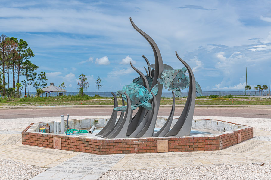
Visitors can experience these habitats while kayaking, boating, hiking or simply walking the shoreline, but wildlife should be observed from a safe distance and nesting areas should never be disturbed.
Exploring the Forgotten Coast
The best way to experience the Forgotten Coast is often to move between its different environments rather than remain in a single destination. A trip can combine the historic streets of Apalachicola with the beaches of St. George Island, the protected waters of St. Joseph Bay, the shoreline of Cape San Blas and the small waterfront communities along U.S. Highway 98.
Boating, fishing and paddling provide access to parts of the region that cannot be fully appreciated from land. On shore, visitors can explore historic districts, lighthouses, state parks, beaches, seafood restaurants and forested recreation areas. On St. George Island, visitors can explore St. George Island State Park and the St. George Island Lighthouse Museum.
Distances between communities are manageable, but a vehicle is useful because attractions and natural areas are spread across the coastline. The drives themselves are part of the experience, particularly where U.S. 98 passes alongside bays, marshes and undeveloped coastal landscapes.
When to Visit the Forgotten Coast
Spring and fall bring comfortable conditions for exploring towns, beaches and natural areas, while summer offers warm Gulf water and long days for boating and swimming. Summer is also hot and humid, with thunderstorms common during the warmer months.
Winter is generally quieter and can be an appealing time for fishing, hiking, sightseeing and exploring historic communities. Because Northwest Florida experiences greater seasonal temperature changes than South Florida, winter cold fronts can occasionally bring surprisingly cool conditions.
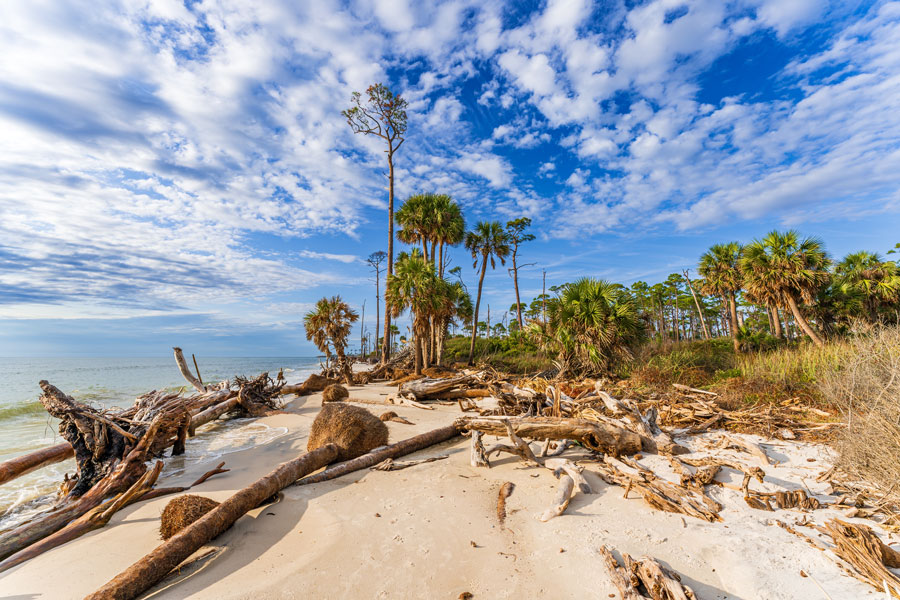
Hurricanes and tropical storms have repeatedly affected this coastline and continue to shape both its communities and natural environment. Visitors traveling during hurricane season should monitor current forecasts and follow local guidance, particularly when staying on St. George Island, Cape San Blas or other locations with limited evacuation routes.
Getting to the Forgotten Coast
The Forgotten Coast is primarily a driving destination. U.S. Highway 98 connects many of its communities, including Port St. Joe, Apalachicola, Eastpoint and Carrabelle, while local roads provide access to Cape San Blas and bridges connect the mainland with St. George Island.
There is no major commercial airport in the center of the region. Northwest Florida Beaches International Airport near Panama City provides access from the west, while Tallahassee International Airport is another option for travelers approaching from the northeast. St. George Island Airport is located on the island but does not provide the scheduled commercial airline service available at the larger regional airports. A rental vehicle is generally the most practical way to explore the coast after arriving.
Vicinity of Florida’s Forgotten Coast
Additional Details
| Region | Forgotten Coast / Eastern Florida Panhandle |
| Coast | Gulf Coast |
| Primary Counties | Gulf and Franklin counties |
| Primary Destinations | Port St. Joe, Apalachicola, Eastpoint, St. George Island, Cape San Blas and Carrabelle |
| Major Natural Areas | Apalachicola River and Bay, St. Joseph Bay, Cape San Blas, Dr. Julian G. Bruce St. George Island State Park, St. Joseph Peninsula State Park and Tate’s Hell State Forest |
| Historic and Maritime Sites | Cape St. George Lighthouse, Crooked River Lighthouse, historic Apalachicola and the region’s working waterfronts |
| Major Coastal Route | U.S. Highway 98 |
| Nearby Airports | Tallahassee International Airport, Northwest Florida Beaches International Airport and St. George Island Airport |
| Known For | Working waterfronts, seafood and oyster heritage, fishing, barrier islands, lighthouses, undeveloped beaches, estuaries, forests and protected coastal landscapes |
| Best Time to Visit | Year-round, with spring and fall offering especially comfortable conditions for beaches, boating, fishing, paddling and exploring historic communities |
Exploring Florida’s Forgotten Coast
Florida’s Forgotten Coast is best experienced by moving between its historic waterfront communities and natural landscapes. Port St. Joe provides access to St. Joseph Bay and Cape San Blas, while Apalachicola remains closely tied to the Apalachicola River, bay, seafood industry and working waterfront. Eastpoint serves as the mainland gateway to St. George Island, where visitors can explore Gulf beaches, Dr. Julian G. Bruce St. George Island State Park and the Cape St. George Lighthouse.
The natural environment is as important to the region as its towns. The Apalachicola River and Bay, St. Joseph Bay, Cape San Blas, barrier islands, salt marshes, forests and long stretches of undeveloped shoreline support boating, fishing, paddling, birding and wildlife viewing. The relatively low level of coastal development also allows places such as St. George Island State Park to remain central to the experience rather than isolated pockets of nature surrounded by dense resort development.
From the waterfront of Port St. Joe and the beaches of Cape San Blas to Apalachicola’s maritime heritage and the beaches and lighthouse of St. George Island, the Forgotten Coast offers a quieter and more natural side of Northwest Florida. Visitors arriving through Tallahassee International Airport or Northwest Florida Beaches International Airport can use U.S. Highway 98 to connect many of these communities, making the drive itself part of exploring this distinctive stretch of Florida’s Gulf Coast.